Plane spotted in BHEL Stadium on Google Maps sparks Reddit discussion
A Reddit post showing what appeared to be an aircraft inside Hyderabad’s BHEL Stadium on Google Maps sparked curiosity online. Users explained that the image captured a plane mid-flight, a common satellite imaging effect caused by fast-moving objects.
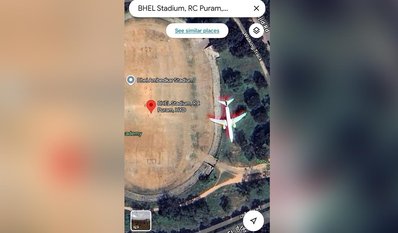
Hyderabad: Some discussion threads on Reddit can be genuinely amusing, like the one triggered by an aircraft spotted on Google Maps, with the image appearing as if a plane was parked right inside the BHEL Stadium.
The thread began two days ago after a Redditor, ICTFS, posted on the Hyderabad subreddit, r/hyderabad, that he had “spotted this while browsing maps randomly”, with the title, “Is this a real plane inside BHEL Stadium or just Google Maps tripping?”
Redditors were quick to respond, with the initial explanations being largely technical. One user pointed out that the aircraft was “captured mid-flight”, citing visible colour ghosting, also referred to as chromatic aberration, and described it as a relatively rare visual artefact. Another explained that the effect occurs because satellites use separate sensors to capture red, green and blue layers, resulting in colour gradients when fast-moving objects are recorded sequentially and later merged.
“The plane was flying over the stadium as this image was captured. If you see around the aircraft, the colours are slightly shifted. It’s because the satellite image couldn’t capture the flight’s colours at a single point since it was moving,” one explanation read, attributing the effect to chromatic aberration.
The explanations kept coming. Perhaps the best explanation came from another Redditor, who said:
“Imagine you asked your friend to take your picture, but some random stranger came between you and your friend at the exact same time when he clicked the shutter button.” Simple and clear, wasn’t it.
As for the actual explanation, there is clearly no aircraft parked inside the BHEL Stadium. Several threads on Reddit itself note that Google Maps satellite view often captures planes mid-flight, a common occurrence given the way satellites in low Earth orbit photograph the planet. Google Maps and Google Earth rely on high-resolution satellite imagery, and if an aircraft happens to be passing through a particular grid at the time of capture, it becomes part of the final image.
Given the sheer number of planes in the air at any given moment, it is very common to find them in Google Maps satellite imagery, explains another thread, and true to that, there are many such images if one has the inclination to search.
Related News
-

32 Telangana boat drivers trained in CPR, AED skills at Hussain Sagar
-
Seven-year-old Nyra Bainagari solves 154 Smothered Mate chess puzzles, eyes world record
-
Andhra Pradesh working to translocate female tigers to Eastern Ghats: Pawan Kalyan
-
Congress accused of double standards over student protests in Telangana