Somalayas are biggest mountain range you will never see, say geologists
Utrecht: Every geography schoolbook has them: maps that look like today’s Earth, but not quite, since all continents are merged into a single supercontinent. Those maps were used to explain why dinosaurs in South America and Africa, or North America and Europe looked so alike. “Paleogeographic” reconstructions like these provide context to study the processes […]
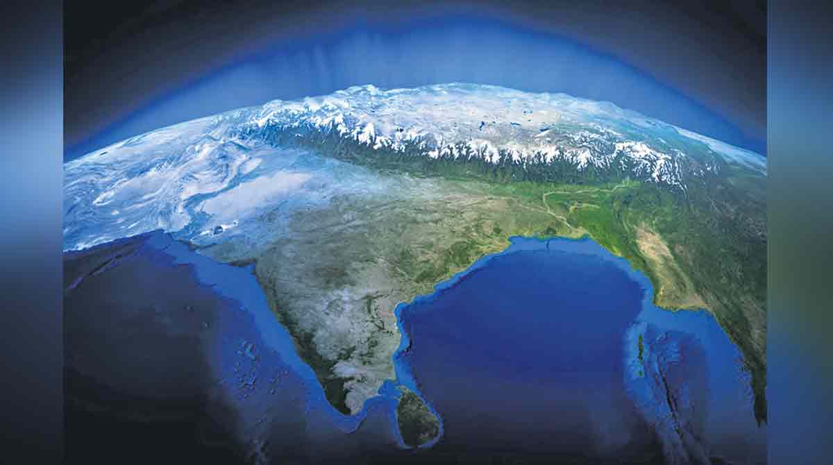
Utrecht: Every geography schoolbook has them: maps that look like today’s Earth, but not quite, since all continents are merged into a single supercontinent.
Those maps were used to explain why dinosaurs in South America and Africa, or North America and Europe looked so alike.
“Paleogeographic” reconstructions like these provide context to study the processes that shape our planet: the Earth’s engines of plate tectonics, volcanism, and mountain building, and their interactions with the oceans, atmosphere, and sun that shape climate and life.
In the past ten years software has been developed that means anyone who is interested can make these reconstructions. But if paleogeographic maps were already in our primary school textbooks, then what are geologists trying to uncover? Just the details? To some extent: yes, working out the details of plate motions in the distant past may make all the difference.
But the biggest problem for paleogeography is not the details: it’s that as much as 70 per cent of the Earth’s crust that existed as “recently” as 150-200 million years ago, when dinosaurs were already roaming the planet, has been lost to subduction into the Earth’s inner mantle.
But there are relics of this subducted crust left in the geological record. Many mountains, most famously the Himalayas, are made of folded and stacked slices of rock that were scraped off the subducted plate. And the types of rock and the fossils and minerals they contain can tell us when and where these rocks formed.
Geologists can then piece together how those continents and deep basins and volcanoes linked together in the distant past.
And when a thought of predicting future moutains had occured, it was understood that the researchers would have to predict how the geography that they knew well would transform into mountain belts.
An an experiment, the researchers, using the rules to predict the geological architecture of a mountain belt that will form in the next 200 million years, tried to understand the outcome if Somalia, as expected, breaks off from Africa and collides with India.
The resulting mountain range, which can be called the “Somalaya mountains”, might be the Himalayas of their day. And seeing such similarities between the Somalaya and known mountains today can provide possible solutions that were never thought of for paleogeographic evolution.
Thought experiments like our look at the Somalayas help us to realise what we overlook when reconstructing the history of the Earth’s plates and surface. The better those reconstructions, the better we will predict Earth’s history and behaviour, its resources, and the effects of using them.
Now you can get handpicked stories from Telangana Today on Telegram everyday. Click the link to subscribe.
Click to follow Telangana Today Facebook page and Twitter .
Related News
-

President Murmu to visit Moldova, North Macedonia, Romania from July 19
-
Former US Security Adviser warns Trump policies driving allies away
-
China pushes African nations to shift debt repayments from US dollar to yuan
-
Piyush Goyal to visit Spain, Belgium, Finland to strengthen India-Europe economic ties