Telangana urges Centre to take up backwater study of Polavaram to prevent submergence
Hyderabad: Telangana has once again requested Ministry of Jal Shakti (MoJS) and Central Water Commission (CWC) to conduct a comprehensive backwater study through an independent competent agency at the earliest and take suitable protection measures in areas to be affected in Telangana territory due to backwaters and prevent large scale submergence. In a letter to […]
Hyderabad: Telangana has once again requested Ministry of Jal Shakti (MoJS) and Central Water Commission (CWC) to conduct a comprehensive backwater study through an independent competent agency at the earliest and take suitable protection measures in areas to be affected in Telangana territory due to backwaters and prevent large scale submergence.
In a letter to Polavaram Project Authority (PPA) Chief Executive Officer, Telangana Irrigation and Command Area Development (I&CAD) Engineer-in-Chief (General) C Muralidhar urged to ascertain the extent of area getting affected in Telangana territory due to backwaters upstream of the Polavaram project by undertaking a comprehensive study for revised Probable Maximum Flood (PMF) of 50 lakhs cusecs.
The backwater studies carried out by CWC and AP thus far for only 36 lakhs cusecs flood does not contain critical information like backwater levels, cross sectional profiles at historical temple town of Bhadrachalam and at Manuguru Heavy Water Plant.
It was brought to the notice that these important structures including coal mines are likely to be affected by submergence and other effects causing loss and destruction in the areas in Telangana.
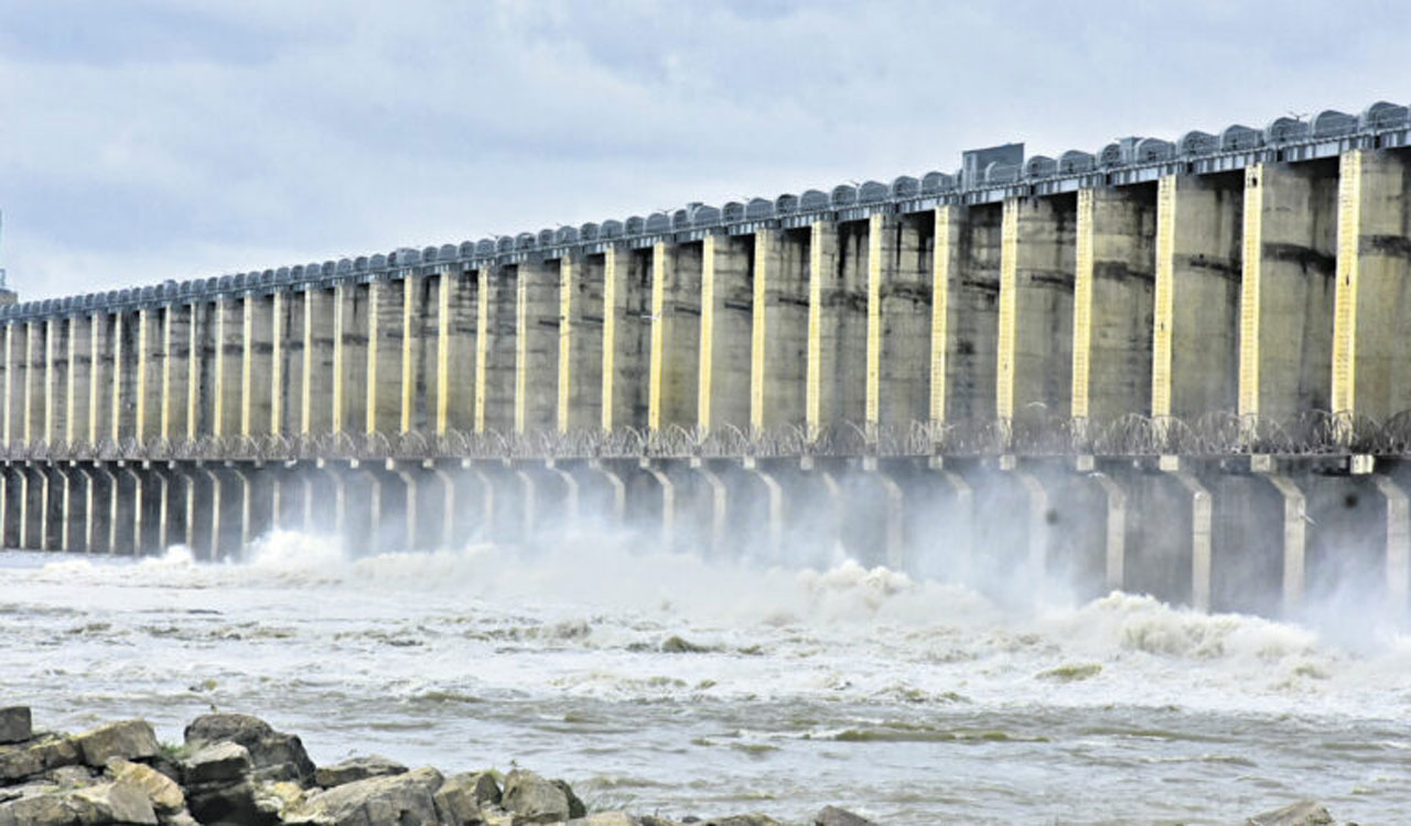
The water depth at Bhadrachalam (river bed level of 107 ft) will be more than 28 feet throughout the year with Polavaram project at Minimum Draw Down Level (MDDL) condition ( 135 feet) and will be 43 feet if FRL ( 150 feet) is maintained at Polavaram.
The first warning level of Godavari at Bhadrachalam is 150 feet ( 45.73 m), second warning level is at 155 feet ( 47.14 m) and danger level is at 160 ft ( 48.77 m).
Muralidhar said various studies for different magnitudes of flood conducted revealed that the backwater level worked out at Bhadrachalam and Dummugudem are 58.32 m (191.35 feet) and 64.29 m (210.94 feet) respectively for flood of 36 lakhs cusecs and 62.85 m (206.20 feet) and 65.31 m (214.30 feet) respectively with operating level of 42.67 m (i.e. 140 feet; FRL being 150 feet). The area affected is 184.79 Sq. Km.
The affected villages for both the scenario of floods include 74 villages and 92 villages in the State. A population of about 1.2 lakhs are likely to be affected by submergence.
All the above aspects along with the likely impact by inundation of important places of Telangana due to Polavaram project was raised with MoJS, CWC and PPA during meetings with the PPA and Godavari River Management Board (GRMB) held thus far.
The PPA as a nodal agency for construction of Polavaram project should initiate measures for safeguarding the territory of Telangana and its inhabitants. This becomes more pronounced, as due to recent flood, more inundation around Bhadrachalam temple premises and near flood bank (Karakatta) is observed than the affected area during 1986 High Flood Level (HFL).
The MWL of the observed flood in 1986 at Bhadrachalam is 55.65 m (182.60 feet) with estimated discharge of 27 lakhs cusecs.
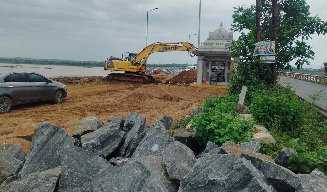
The sacred temple town Bhadrachalam known as Dakshina Ayodhya is located on left flank at 1236 km from the Godavari River origin. In this flood year, the water level at Bhadrachalam gradually rose from a normal level of 38.71 mts (127.00 feet) on July 9, 2022 to as high as 54.35 mts (178.30 feet) on July 16, 2022 at 1 am with an estimated discharge of about 24.50 lakhs cusecs.
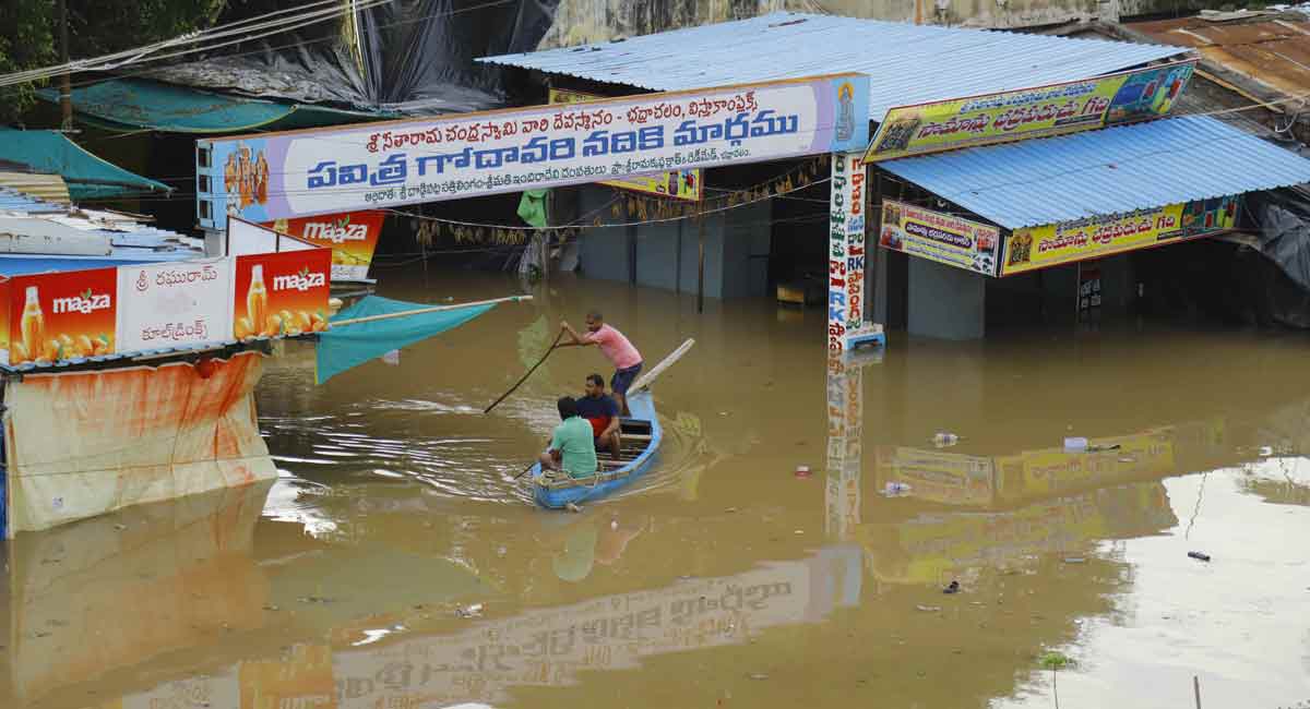
Several areas/villages of Pinapaka, Aswapuram and Burgampahad mandals on right bank and Bhadrachalam, Dummugudem and Charla mandals on left bank got affected. The inundation continued for five days in Bhadrachalam town and surrounding villages which is an un-natural phenomenon.
The backwater levels impacting Bhadrachalam town will become a common phenomenon once the Polavaram project is completed and water is stored at FRL level as successive floods within a water year are a common feature in the lower Godavari basin.
When Polavaram is stored at FRL, it is certain that the flood level at Bhadrachalam would be further compounded. IIT Roorkee estimated the PMF as 58 lakh cusecs and the backwater levels at upstream of Konta on River Sabari as 218.40 feet with 58 lakh cusecs against the 180.15 feet with 36 lakh cusecs as computed by CWC.
A similar increase in backwaters levels on main river Godavari will result inextensive submersion of temple town of Bhadrachalam, habitations, forests etc and cause irreparable damage.
The heavy water plant at Manuguru situated at a distance of about one km adjacent to Dummugudem anicut on main River Godavari is also bound to face the impact of flooding.
There would also be local streams joining river Godavari in the reach of the Telangana area and will face drainage congestion along the river banks in Telangana territory.
It was requested to ensure for demarcating the areas affected due to drainage congestions along Kinnerasani and Murreduvagu rivers and take necessary safeguards/protection measures against such drainage stagnations.
A request was made to the AP government for necessary action for demarcation of such areas. The response is still awaited. After examining the detailed possible adverse effects of Polavaram project backwaters, we once again request to conduct a comprehensive backwater study by an independent competent agency at the earliest,” Muralidhar said.
He also urged to take suitable protection measures at the affected areas in Telangana territory and prevent large scale submergence.