Kothagudem: Cartosat imagery proves Yerrabodu Gutti Koya habitation is recent encroachment
The forest department officials have photographic evidence based on Cartosat imagery to prove their argument.
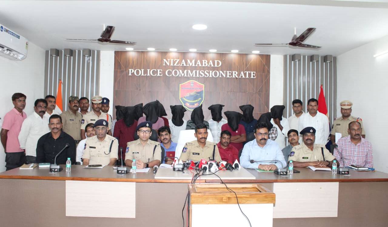
Kothagudem: The State Forest department has come up with evidence to prove that the Yerrabodu Gutti Koya habitation, where forest range officer Ch Srinivas Rao was killed recently, in the district was a recent encroachment made after destroying forests in a large area.
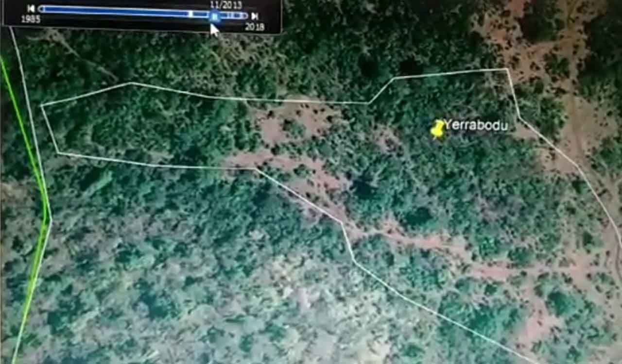
The forest department officials have photographic evidence based on Cartosat imagery to prove their argument. Speaking to Telangana Today, District Forest Officer (DFO) Ranjith Naik stated that the imagery obtained by the department clearly shows the existence of thick forest prior to 2013. The timeline of the imagery was sufficient enough to refute the claims of Gutti Koyas and a section of media who were saying that the residents of the habitation were living there since 2003. Gutti Koyas of Yerrabodu had started podu cultivation only in 2014-15, he said.
Also Read
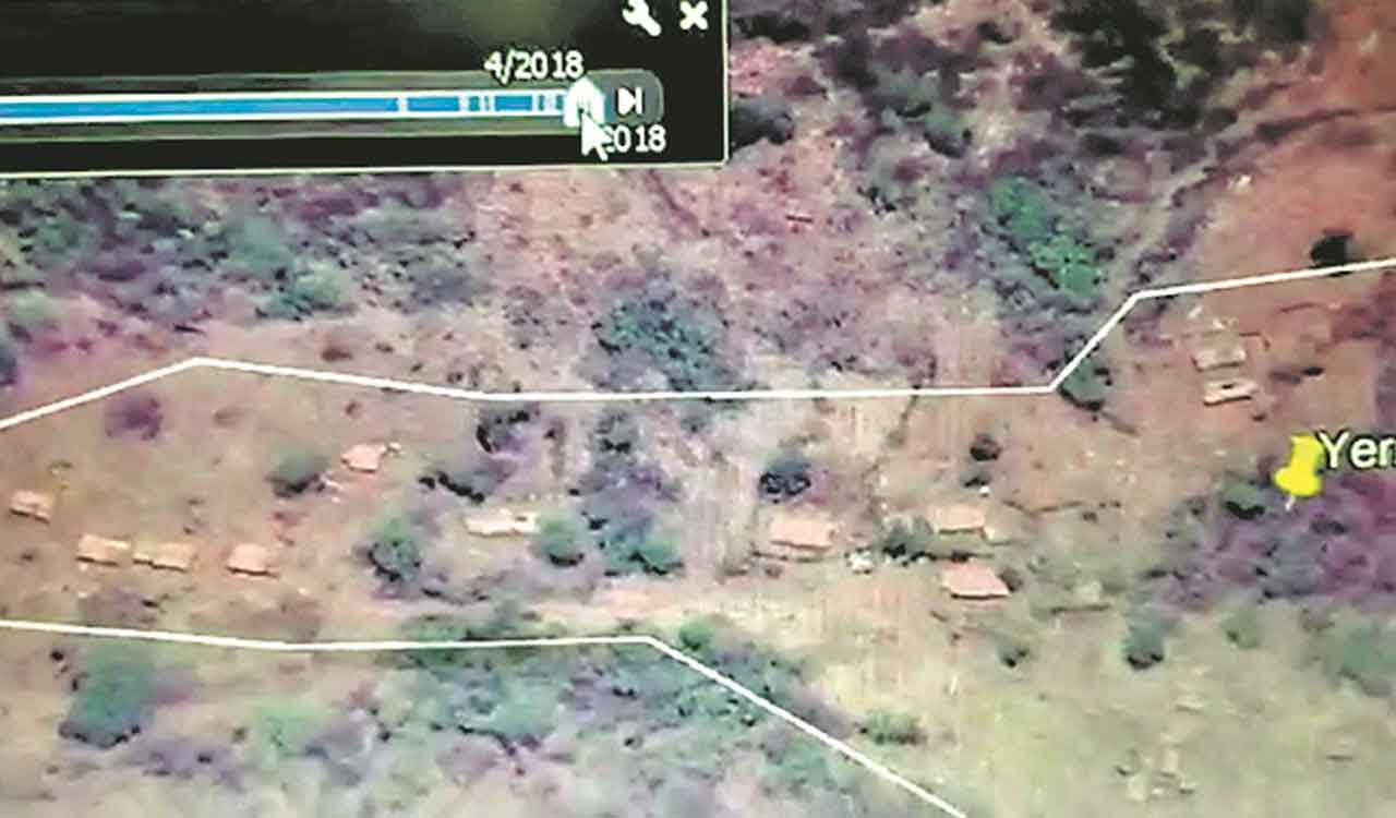
The satellite imagery shows the existence of thick forests till 2013, and as the timeline progresses, how the greenery starts to disappear, in other terms, the gradual destruction of forest area. By 2015-2016, some hutments start to surface, and by 2018, there is a large habitation with several man-made structures, and a large space devoid of trees. This Gutti Koya habitation comes under Bedalapadu gram panchayat of Chandrugonda mandal and was part of the Kanakagiri hillocks, Naik said.
According to a senior forest officer who accompanied DFO (Vigilance) Ramana Reddy during an enquiry into the killing of the FRO at the habitation, the total deforested area was around 35 hectares, of which 15 hectares falls into Kothagudem division and 20 hectares into Khammam division.
Of the 15 hectares of deforested area, 10 hectares were retrieved and a plantation was developed. As per the Scheduled Tribes and Other Traditional Forest Dwellers (RoFR) Act, 2006, podu cultivators would be given a certificate of right for cultivation only.
Those given the certificate of right could only cultivate a small piece of land for their livelihood but they would not be the owners of that land. The ownership of such lands remains with the Forest department, he said.